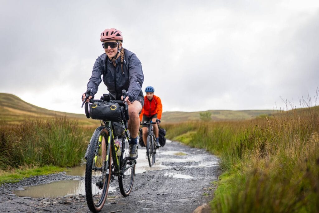
To describe this as a gravel event is probably a bit misleading. Yes, it does have some sumptuous gravel in it. But it is better thought of as a very beautiful (but somewhat tortuous) obstacle course to be tackled by bike. With everything from hike-a-bike and single track to smooth forestry tracks and sweeping asphalt, this ride is for people looking to take drop bar bikes where they don’t belong.
The route is around 65% tarmac (in distance not time), so this is gravel bike territory. The aim when designing the route has been to include a mix of everything but keep the really tough stuff short and sharp, using hike-a-bike and singletrack to link less technical road and gravel sections. That being said, this will not be a fast ride, not least because of the sheer amount of climbing. But if you’re looking for an adventure that takes in all the best of the Welsh mountains then look no further.
Entry fee: £195 per rider
Start: Saturday 15th August 2026
Registration: Friday 14th August 2026
About Mountains of the Merfynion
- Registration and briefing will be in the afternoon/evening of Friday 14th August 2026
- Starts at 09:00 on Saturday 15th August at Llwyn Celyn, near Abergavenny
- The route is around 730 kilometres with 14,000 metres of climbing
- This is a single-stage unsupported ultra-endurance event
- There will be a series of unmanned selfie checkpoints along the route
- The finishing cut-off is midday on Thursday 20th August
- Live tracking will be provided by Follow My Challenge using GPS trackers
- This event will require additional minimum kit for safety: a bivvy bag and either a sleeping bag or a hooded down jacket must be carried at all times. A working mobile phone is also mandatory at all times.
Why Take on Mountains of the Merfynion?
Anyone who has ridden in Wales will know just how good the cycling is. But this good cycling continues long after the roads end, as the Mountains of the Merfynion route aims to demonstrate.
We’ve aimed to put this route in that sweet spot where riding it on a mountain bike would be too tame, but you’re going to be pushing your limits on a gravel bike in places.
Add to this some beautifully quiet tarmacked riding, with tough climbs and sweeping descents, and you have an extremely varied route. And that’s before we even mention the sneaky sections of hike-a-bike that have made their way in there…
Overview of the Route

Llwyn Celyn
For 2025, we moved the start and finish to Llwyn Celyn, a medieval site in the Llanthony Valley, close to Abergavenny. Registration will take place in the Threshing Barn and we will have access to the Llwyn Celyn Bunkhouse throughout the event.
This location is perfect for getting straight into the Welsh hills and has allowed us to shorten the loop slightly without removing any of the best riding. And the bunkhouse setup means that there will be spare bunks available for anyone finishing later, as well as showers and toilets.
Into the Bannau Brycheiniog (Brecon Beacons)
The route begins in the foothills of the Black Mountains, but you instead head towards the Bannau Brycheiniog (Brecon Beacons) via the South Wales Valleys. The Tumble warms up the legs, with the route beginning on quiet lanes.
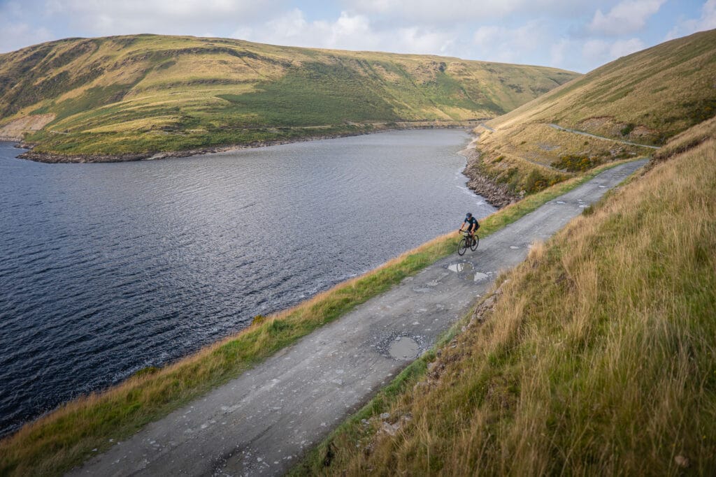
From then on, the hills rarely relent as the as the route weaves its way towards the ridge above the Talybont Reservoir, where you will find the first checkpoint. Every surface awaits, from rocky single track to smooth rail trail.
Out of the Bannau Brycheiniog (Brecon Beacons)
Through the Bannau Brycheiniog (Brecon Beacons), the hills come thick and fast. The route winds its way almost to the coast, taking you into the Valleys again. This includes a stretch of exposed single-track with panoramic views above Rhigos.
You exit the national park via the beautiful Devil’s Elbow climb, which we have “improved” by taking you onto gravel towards the top, joining a section of the Sarn Helen route.
The Western Cambrians and the Welsh Desert
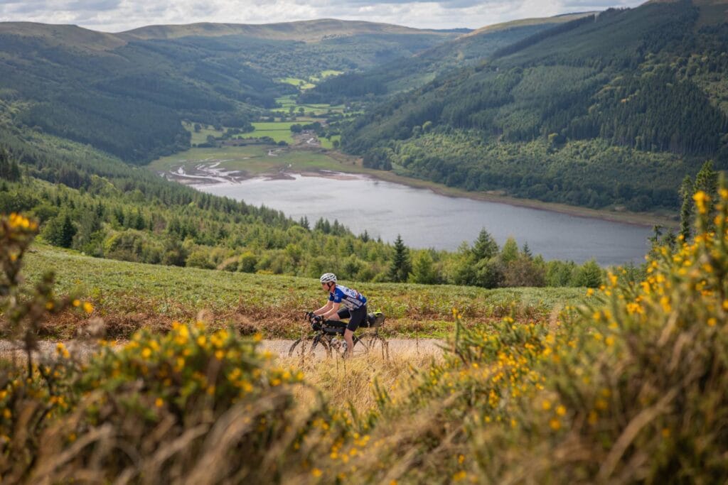
After Llandovery, you head into the Cambrians – the wildest, remotest part of the route. Here, you follow a series of reservoirs, largely sticking to fast forestry gravel, interspersed with beautiful Welsh country roads. This is central Wales at its absolute best.
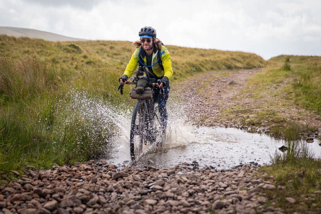
A few rockier sections and a handful of fords (especially the knee-deep crossing before Nant-y-Moch) will keep you on your toes for this section. And the constant up-and-down nature of the terrain, as well as the lack of resupply, make this a challenging stretch.

Into Eryri (Snowdonia)
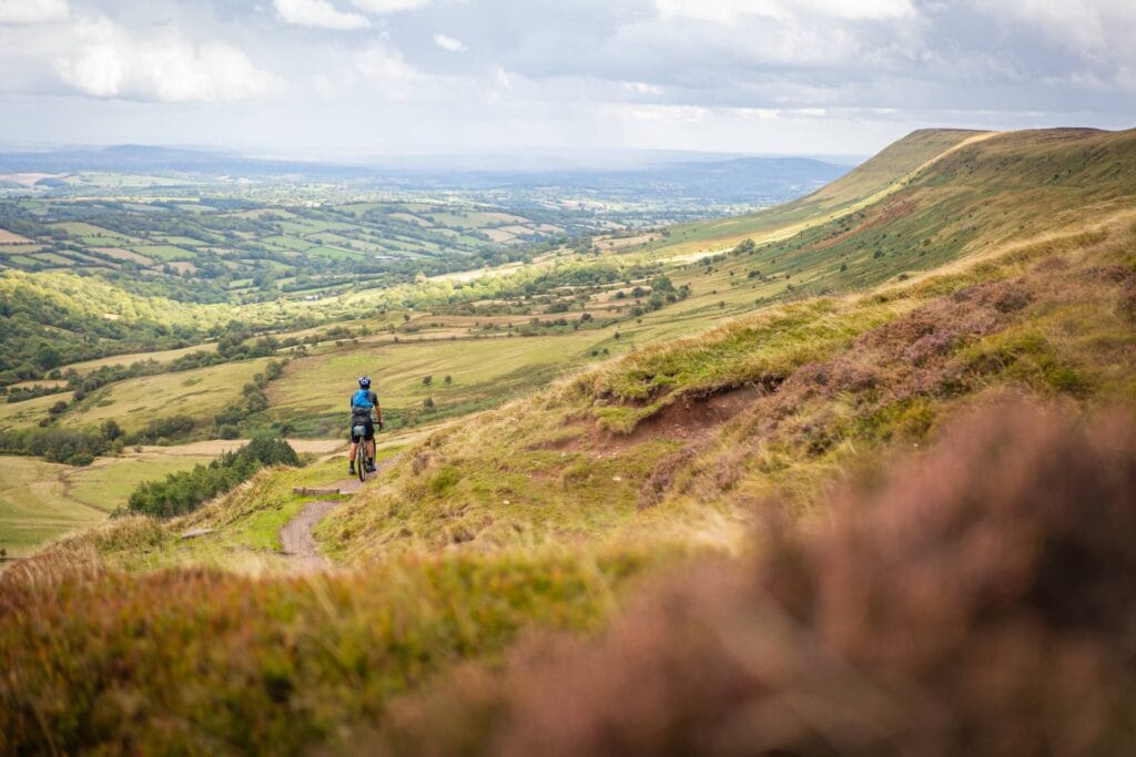
A fast descent to Machynlleth takes you into Eryri (Snowdonia), as the route begins to shadow the coastline. Follow grassy ridges and rocky tracks, with views of sea, mountains and estuary. This section is slow-going but the highlight of the route for many.
After the Penmaenpool Toll Bridge, the riding sticks mainly to peaceful country roads, with a few stretches of forestry gravel to link things up. But any respite is limited, as you tackle a succession of tough but beautiful passes.
Out of Eryri (Snowdonia)
From Bala, the route takes you up towards the Hirwaun Pass, but you switch to gravel before the top. This exposed track takes you over a procession of heather-topped peaks, with views back towards Eryri (Snowdonia).
As you leave the mountains of Eryri (Snowdonia) behind, the route crosses hilltop wind farms, with little flat riding on offer despite the lower elevation.


Back Across the Eastern Cambrians
Soon, your return journey takes you back into the Cambrians. The landscape on this side of the hills is more agricultural and less obviously wild, but the riding is just as tough.
You climb up into a succession of quiet valleys, before inevitably heading onto gravel and traversing an exposed hilltop. The surfaces are varied and slower going, with some hike-a-bike in places. But it is also beautiful riding, often including tracks that even locals have forgotten about.
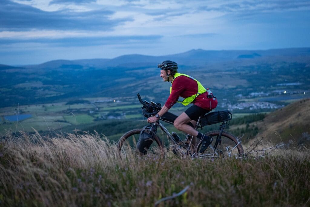
The Black Mountains
Just as the landscape begins to flatten and the English border beckons, the biggest challenge of the entire route rears up ahead of you – Hay Bluff. You begin the ascent on tarmac, before joining a grassy bridleway that takes you up to within 50 metres of the peak.
At the top, the bridleway disappears into a maze sheep tracks. But you are spoilt by endless views of the landscape 600 metres below you (if it isn’t pitch black or cloudy). Aside from a rocky stretch, the descent is mostly rideable. Soon, asphalt reappears, as you head back to the bunkhouse to finish.
What is Included?
Entry into the event
GPX route file
Detailed rider manual (provided around 6-8 weeks before)
Live GPS tracking (including tracker) throughout via Follow My Challenge
Numbered cotton cycling cap (2026 design)
Finisher’s t-shirt
Registration and start at Llwyn Celyn Threshing Barn
Finishing checkpoint at Llwyn Celyn Bunkhouse
A bunk, shower and hot meal when you finish
Carbon offsetting against any emissions associated with running the event
£75 off any purchase of a Zolla wheelset
Copies of all event photos for personal use
*Your entry pays forward a meal for someone in the local community via The Long Table*
Route Map
This is a provisional route and may change. The final route will be sent to you around six weeks before the start.
FAQs
What does unsupported mean?
It means that you can make use of any publicly-available commercial facilities during your ride e.g. shops, hotels etc. Or you can use items that you brought with you from the start. You cannot rely on any help that would not be available to all riders e.g. staying with friends, assistance from other riders or supply stashes.
What tyres do you recommend?
Most of the original recce rides were ridden using 35mm gravel tyres. However, more recent recces have been on 45mm tyres and we would certainly recommend 40-50mm tyres ideally. This would give you more comfort without sacrificing speed, so that’s probably the sweet spot. If you head into MTB tyre territory then you will find it slow going on the road sections (but very comfy elsewhere). Conversely, if you go below 35mm or opt for very slick treads, then you will struggle on rougher sections.
Why have you included an additional minimum kit requirement?
The route is remote and exposed in places, and accommodation options are very limited. Whilst you are never that far from civilisation as the crow flies, you will be riding a bike not a crow. Therefore, in case the weather changes for the worse or you have a serious mechanical, we think it’s important you have enough kit to survive. Please bear in mind that this is an absolute minimum and not a kit list. We do not think the optimum strategy for this route is to ride with as little kit as possible.
Is off-road riding experience required?
Given the tough and exposed nature of the route, we would not recommend entering if you have little experience riding off road. Having said that, we did have riders in 2023 and 2025 who had practically no off-road experience (and were open about this) and rode within their ability to be able to finish. Generally, this isn’t recommended though and, although the riding isn’t particularly technical, it will definitely test you.
How much hike-a-bike is there?
This depends on your legs! There are a few sections where you will inevitably walk to save your legs. And there are a couple of sustained bits that are definitely unrideable due to overgrown/lost paths. However, the hike-a-bike throughout the route is fairly safe – free of steep drops and loose surfaces.
How many entries are available?
We will be limiting entries to 40 places. Entries will close around six weeks prior to the start or when the event is full.
We limit our entries to a lower level than many other events. There are a few reasons that we do this. The rule of thumb has always been that we need to be able to remember everyone’s name and, therefore, this dictates the maximum number of riders. But beyond this, we also consider logistical constraints, as well as the desire to ensure we photograph all riders, ideally multiple times along the route.
Can I leave a bag at the start?
Yes, we will give you a label to put on your bag at registration.
Where is the nearest train station?
Abergavenny is the closest station and is about 30 mins away by bike.
Can I use my own tracker?
No, for simplicity’s sake (and to avoid using disposable batteries) we will only be using Follow My Challenge’s Queclink trackers.
Can pairs enter?
Yes, we have solo and pairs categories for all our events. When you enter, you can choose which you want to register for and will have the opportunity to say who your other half is if you’re entering as a pair.
Some other events have discounts for pairs, but please note that we don’t offer this. Our pricing is simply based on our costs and there are no cost savings for us if you enter as a pair.
What kind of bike can I use?
You will need a regular commercially available solo* upright bike. However, it’s important that it is suitable for the kind of riding that the event will entail, since our routes are designed to be challenging. The right equipment is required to ride them safely and to minimise risk. For example, that means your bike needs to have brakes capable of handling steep, sustained descents. If you have any concerns that your bike may not be suitable/appropriate, please get in touch and we will be happy to advise.
*Tandems are also permitted for TPA and WWC, but you will be placed in a separate category rather than the pairs one.
Can I book accommodation along the route in advance?
Yes, you can! We know that some events restrict this, but we don’t. There are several reasons for this, but it is partly to help reduce costs for riders and make things less daunting for those with less experience. For those looking to push themselves, pre-booking accommodation rarely works and often becomes a hindrance rather than a help. Therefore, we find it is normally only less experienced and less competitive riders who take advantage of this rule.
Can I use the photos taken during the event?
Yes! Everyone who takes part will be sent an album of all the photos taken during the event. This is typically several hundred and will include not just the best photos but a wide variety. We realise that a photo may have significance or importance to a rider beyond its pure aesthetics, so we try not to be too selective with our editing.
You are welcome to use these photos for personal use, which includes personal social media and personal blogs. Please credit The Perfidious Albion when you do this. You cannot use these photos for any kind of commercial use. However, we grant exceptions to this on a case-by-case basis for business blogs and social posts. Please ask for permission if you would like to do this.
Will friends and family be able to follow me during the event?
Yes! There are several ways that people can keep up with your progress during the event. You will have a GPS tracker provided by Follow My Challenge and this will be linked to a webpage, which we will share in the week before the start. Here, your dot will be visible and people will be able to follow your progress along the route.
As well as this, our team will be out on the route getting photos, videos and insight from all the riders. Our aim is to try and cover the whole field, meaning that everyone is intercepted at least once. A selection of photos and videos will be published as posts and stories on our Instagram account several times a day during the event, accompanied by brief updates on riders’ progress.
Finally, we have also teamed up with DotWatcher to provide in-event commentary on their site, accompanied by an embedded version of the event tracking map. Here, a commentator (either a volunteer or one of the team) will take you through each day’s events, giving an overview of riders’ progress as well as sharing any tales from the road.
Is this a race?
You may have noticed that we don’t describe any of our events as races. There are a few reasons for this, but the key thing is that we don’t want to define success or failure for you. For some people, just finishing is the main challenge. For others, they will have a set time goal in mind. Then some of you will think you aren’t competitive until you get sucked into an arduous day-long battle for mid-pack places. And, finally, there will be those that simply want to be first across the line.
Basically, whatever we call this event, you will probably ride it the way you perceive it anyway. The most important thing to remember is that it is just you against the route. Embrace this battle, see what the weather and mechanical gods throw at you along the way, and we’ll see you at the finish.
Because it’s not a race, what should I expect to be different?
As this isn’t a race, we really put the onus on riders to self-police when it comes to respecting the rules and being self-supported. We’re happy to advise and will definitely clarify any ambiguity for riders. But in the end, we’re all adults and there are no prizes, so there is a mutual understanding that the only person you’re cheating is yourself if you don’t respect the rules.
One of the areas that has come into focus in recent years is how strictly events define riding as self-supported. Because our events aren’t races, we intentionally take a slightly more relaxed view and stick to a definition that focuses on avoiding actions that gain a definite advantage, such as drafting, stashing kit etc. We are less worried about actions that could have a potential advantage, such as riding together for a couple of hours or pre-booking accommodation. Of course, we respect that races feel the obligation to prohibit these things and riders should be aware that different events have different rules.
Will you provide info on resupply along the route?
No! We will highlight where resupply options may be limited and will provide a general overview of the route in the rider guide that flags things like this, as well as other potential hazards. But we believe that thoroughly researching the route and doing your own preparations for the ride are an important part of the sport, as well as fitting within our definition of what self-supported means.
Plus, from a safety perspective, we think it’s important that riders familiarise themselves with the route and identify what kit they might need and how much food they should carry.
Where does my entry fee go?
There are some fixed costs associated with running events e.g insurance, web hosting etc., so a small part of the fee covers these. A larger part then covers things like trackers, caps and t-shirts. And then most of what is left (typically the majority with all our events) is used to pay for coverage and photography during the event. This includes logistical costs such as accommodation and transport, as well as staff costs. The final cost, which varies between events, is any start, finish and checkpoint fees that need covering.
It is worth noting that anyone paid during our events is only paid based on days worked, so there is no incentive to make our events more profitable. This means we usually invest in more photography (or a checkpoint during TPA23!) if we feel our budget can be increased. Any profit we do make is either reinvested into the events or given to charity. In 2023, we donated £300 to the bike project at Swindon Welcomes Ukraine.
Sign Up Now
This form should take 5-10 minutes to complete. It involves entering some personal details, followed by answering a few questions, finishing with a card payment to secure your place at the end.
Supported By